About

Take sessions at any time with unlimited access for 30 days on registration.

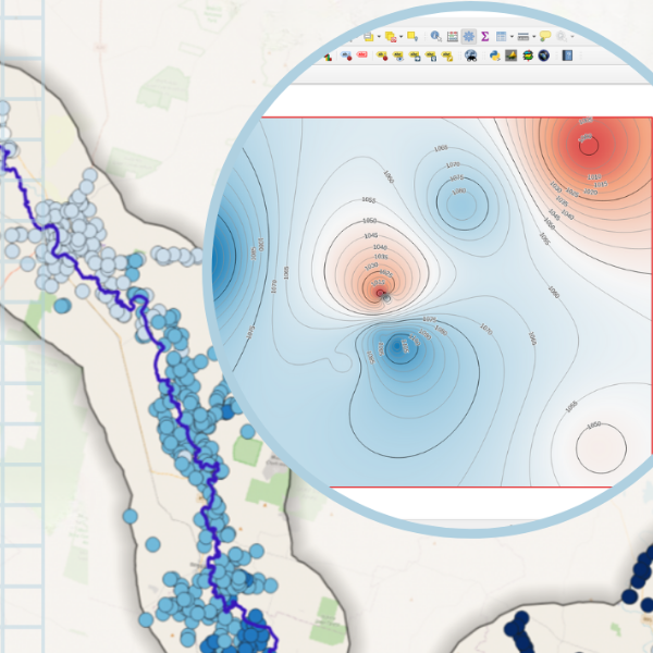
Focusing on an Australian river catchment as a case study, you will learn how load and import data into a QGIS project, process, interpolate and create layers from groundwater data and develop groundwater level maps from borehole data and DEM.

This course is designed for the beginner and is highly practical. 

Don't miss this opportunity, register now for the course for self-pace learning!

Details

Format 3 x 2-hours recordings + course material and resources.
Cost AUD $895.00 (INC GST)
Code OD-24-3-105
Contact training@awschool.com.au
Tags / /

Presenters

Hans van der Kwast

QWAST

Hans van der Kwast has more than 20 years of experience with GIS and Remote Sensing in education and projects, offering consultancy, training and coaching in open source GIS. He is an active member in... Read more

Kurt Menke

Septima

A former archaeologist and ex-GISP, Kurt Menke is a geospatial generalist based out of Frederiksværk, Denmark. He received a Master’s degree in Geography from the University of New Mexico in 2000. ... Read more

Andreas de Jong

Educated at the University of Southampton and University College London (UK), Andreas de Jong is a freelance hydrogeologist and project manager with international experience in the water sector in ove... Read more

Using data preparation, analysis and mapping you will build a project with step-by-step guidance for our presenters using QGIS and other tools. Through the course you will run, animate, interpret and troubleshoot your project and create an informative map.

Course Outline:

The course covers 3 main topics namely;  

Session 1: Adding groundwater data to a QGIS project

  • Load data from online sources into QGIS
  • Import CSV files
  • Save data and styling to a GeoPackage
  • Save a QGIS project to a GeoPackage

Session 2: Process groundwater data in QGIS

  • Reproject layers
  • Select features by expression
  • Export selected features
  • Create buffers
  • Dissolve features
  • Intersect layers
  • Clip layers
  • Use the Point Sampling Tool
  • Join attributes and make them permanent

Session 3: Create a groundwater level map for borehole data and a DEM

  • Calculate the density of the boreholes in a polygon
  • Download the SRTM 1-Arc Second DEM
  • Clip and reproject a DEM
  • Style a DEM
  • Sample elevation at the borehole location and compare it with the elevation attribute
  • Make corrections and calculations in the attribute table
  • Interpolate groundwater levels of the boreholes to a raster


Format: 

  • 6+ hours of session recordings with unlimited access for 30-days;
  • Pre-and-post-course materials to go through via the AWS learning platform;
  • Homework exercises between the 3 parts;
  • Manual of the course and working model download/s;
  • Ability to ask questions to the presenters at anytime through the learning platform;
  • Attendees earn CPD hours/points (i.e. with Engineers Australia) for at least 12 hours for the entire course.

Preparation:

Pre-course reading and video watching is encouraged. There is also an opportunity to tailor the sessions to your direct questions via the initial survey. After the first week you will be given some exercises to complete, prior to the next session.


Requirements:

A good internet connection and software and downloads as described in the learning platform.


On completion of the course attendees will be issued with a Certificate of Completion.


Refund Policy

Frequently Asked Questions (FAQ)