Video
Webinar: QGIS for water modellers
Learn how to apply free GIS applications and plugins to aid the development and animation of hydrologic and hydraulic models
About
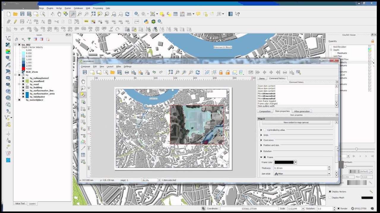
QGIS is a free and open-source cross-platform desktop geographic information system application that is used by water modellers to support viewing, editing, and analysis of geospatial data.
This webinar covers free tools to aid your hydrologic and hydraulic modelling efforts and provides live demonstrations of:
• MDAL: GIS beyond vector and raster
• MDAL integration with QGIS
• Using the mesh layer and Crayfish plugin for animating 2D flood models, including HEC-RAS 2D, TUFLOW, AnuGA, and more!
Presenters
Saber Razmjooei
Lutra Consulting
Saber Razmjooei, is the Managing Director, Lutra Consulting. Saber holds an Msc in Water Resource Engineering. He worked in the water sector in the UK for 10 years, before starting Lutra Consulting. L... Read more

Krey Price
International Water Training Institute
Educated at the University of California at Berkeley, Krey is a civil engineer and project manager with international experience in water resources. He is engaged in computational modelling, engineeri... Read more

Hans van der Kwast
QWAST
Hans van der Kwast has more than 20 years of experience with GIS and Remote Sensing in education and projects, offering consultancy, training and coaching in open source GIS. He is an active member in... Read more